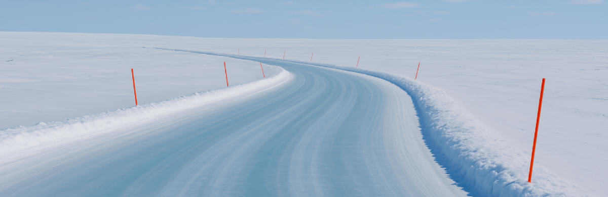
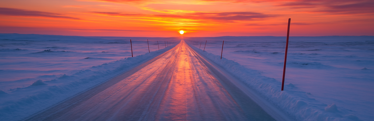
The vast expanse of Alaska’s North Slope presents unique challenges and opportunities for industries dependent on efficient logistics and operations. Among the most captivating and demanding of these challenges is the construction and use of ice roads. Serving as vital lifelines to access remote communities and industrial operations, these frozen pathways have traditionally depended on waiting for the Department of Natural Resources (DNR) approval to open the area or manual testing of ground temperatures to determine their compliance for early access. However, a new era is on the horizon – one where real-time data collection and AI-driven forecasting converge to maximize the ice road operation window.
Understanding the Challenge
The Alaska Department of Natural Resources (DNR) determines when North Slope operators can start ice road construction on state land, granting early-access permits to ice road operators based on real-time, on-site measurements. This testing involves checking if the ground has reached 23°F (-5°C) at a depth of 1 ft (0.3 m), indicating that the active tundra layer (typically a total 2 ft/0.6 m thick in the area) has frozen and is suitable for construction. By reaching this threshold, it is assumed that the active layer is frozen entirely to its 2 ft (0.6 m) depth.
Traditionally, road operators had to drill holes to test the active layer’s frozen thickness, a time-consuming and intrusive method that lacks continuous measurement capabilities. This technique requires fieldwork, exposing workers to potential risks posed by thin ice, unfrozen tundra, or adverse weather conditions.
Real-Time Monitoring: The Foundation of Precision
Enter real-time monitoring: A game-changing approach to ice road operations. The practice of observing tundra temperatures in real-time empowers ice road operations teams with invaluable insights into current conditions. Such insights are instrumental in streamlining operations, minimizing costly delays and standby of equipment and crews, and ensuring that the ice road’s construction aligns with both regulatory requirements and the best interests of the environment.
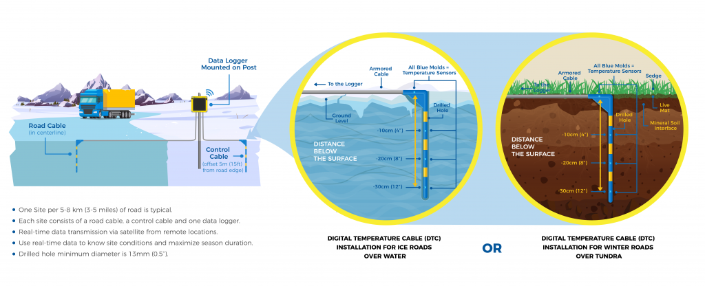
Figure 1: beadedstream’s ice road monitoring station setup
In beadedstream’s approach, ice road operations teams gain access to critical data through strategically placed Ice Road Monitoring Stations (See Figure 1). These stations, located approximately every 5 miles along the road (See Figure 2), consist of data loggers with satellite transmission and two Ice Road Temperature Cables equipped with sensors (one cable for the road and one for control measurements off the road). The collected data is seamlessly sent to the beadedcloud web dashboard, providing operators with a comprehensive view of tundra temperatures in real-time.
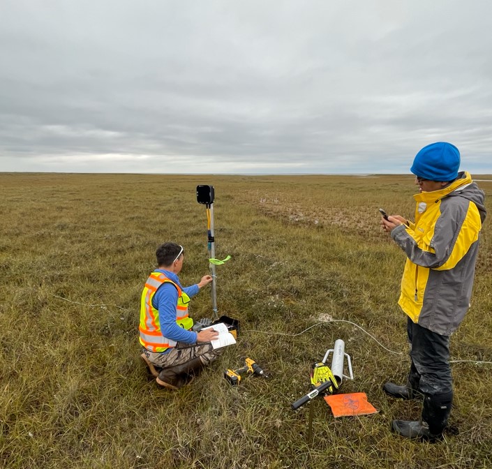
Figure 2: beadedstream team setting up an ice road station in Alaska’s North Slope during the summer.
Unlocking the Power of Real-time Forecasting
One of the most exciting developments in this arena is the integration of AI-driven forecasting. As data from ice road monitoring stations streams in for a period of 35-45 days within the current ice road season, combined with weather forecasts from the National Oceanic and Atmospheric Administration (NOAA), the potential for predictive modeling emerges. This modeling revolves around understanding the trends in tundra temperature and forecasting when the critical threshold of 23°F (-5°C) at a depth of 1 ft (0.3 m) depth will be reached. The knowledge of an ice road estimated opening date 30 days in advance allows operators to better plan construction, optimize utilization, and reduce standby costs for both equipment and crews.
The implications of real-time temperature forecasting extend far beyond immediate operational gains. Ice roads experience changing environmental conditions, and with this reduced window of opportunity, every day gained becomes more precious. Through real-time temperature forecasting, industries can unlock up to 1 to 1.5 months of additional operational time, enabling them to conduct critical winter programs and maximize the use of this frozen infrastructure.
A Glimpse into the Future
While the current landscape offers unprecedented advancements, the future holds even more potential. The fusion of machine learning and forecasting models promises a new era of precision and efficiency. Imagine an AI system that learns from historical data, weather patterns, and other variables to predict ice road readiness with even greater accuracy. This forward-looking approach could redefine how we interact with, harness and protect the Arctic environment.
According to beadedstream’s Chief Operating Officer (COO) Erik Williams, “Machine learning and real-time analytics are the next step in easily collecting data and actionable insights. I envision a future where you can determine whether the ground is frozen or thawing at your site and get alerts if your infrastructure is at risk at any point in the future using the best models. ”
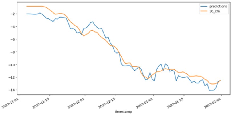
Figure 3: Plot of beadedstream forecasting ground temperature vs. time.
Figure 1 presents a visual representation of the ground temperature forecasting carried out by beaded>stream’s advanced machine learning model (depicted in blue), juxtaposed with actual recorded measurements (depicted in orange). This graph was generated by training the model on a set of data and then comparing it with another set for validation. Notably, the model’s predictive outputs closely mirror the actual temperature measurements, highlighting its impressive accuracy and proficiency in capturing real-world temperature trends.
One of the key advantages of using a model, like beadedstream’s, over manual estimation is the ability to generate alerts for pre-set forecast events and sending them to the users.
Collaboration for a Sustainable Future
beadedstream’s pioneering efforts in ice road monitoring and AI-driven forecasting stand as a testament to the limitless possibilities of data and technology. We are committed to pushing the boundaries of operational efficiency and environmental stewardship. As we explore the untapped potential of machine learning and forecasting, we invite collaborations that share our vision for a more sustainable and resourceful future.
For over two decades, beadedstream has been at the forefront of Arctic monitoring, accumulating extensive experience and insights. If you’re intrigued by the possibilities or eager to join the conversation about the potential of ice road monitoring and forecasting, connect with us at contact@beadedstream.com.