Oil & Gas, Winter/Ice Road
Real-Time Winter/Ice Road Monitoring
“We can forecast the date of reaching target ground temperatures to within 6-7 hours which aids with planning. We’ve been able to get out on tundra 1 to 1.5 months sooner by using temperature sensors for monitoring.”
Federico Lier
Owner - Ninox Consulting and Civil Engineeringlinkedin/beadedstream
844.488.4880
www.beadedstream.com
contact@beadedstream.com
Watch case study
Real-time monitoring of tundra temperatures allows ice road operations teams to understand the current conditions and forecast their opening window. This allows them to prepare their team to mobilize and discuss permits, minimizing delays.
beadedstream Ice Road Monitoring Stations are quick to install and easily provide critical data via beadedcloud to protect the tundra and maximize the open tundra season.
Featured by Ground Control:
This ice road monitoring application was recently highlighted by Ground Control for its use of satellite connectivity in remote Alaska operations.
Read the feature
Click for an instant live demo of the beadedcloud data dashboard for FREE.
Free DemoApplication
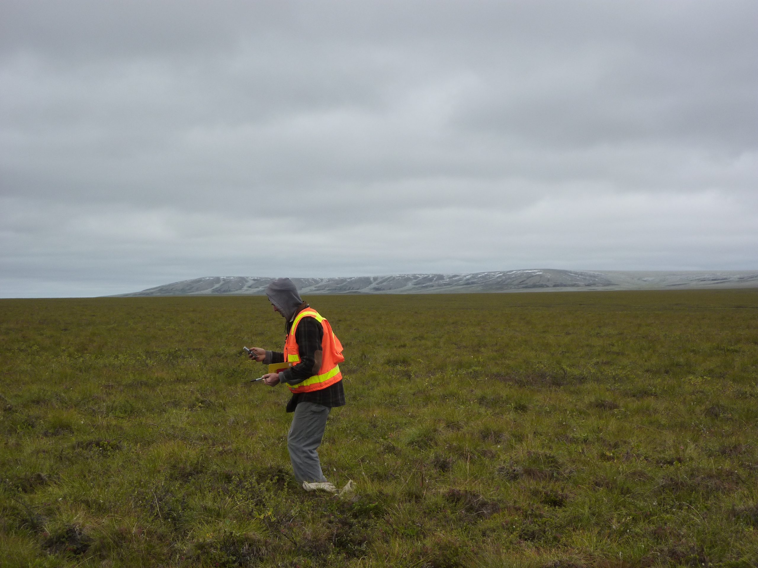
Ice roads are built each winter to access drill pads in Alaska’s North Slope oil fields. At up to 200 miles (322 km) long, they are built over the tundra to mobilize heavy equipment such as drill rigs. Alaska’s Department of Natural Resources (DNR) has regulations for ice road opening. To protect the tundra from damage and allow the equipment to pass safely, the active layer of the permafrost must be frozen before road construction can begin.
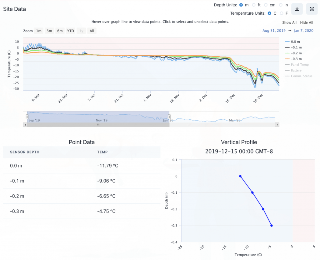
Historically, operators had to either wait for the DNR to open the area or manually test the frozen thickness. By using temperature cables to monitor when the ground reaches 23°F (-5°C) at 1 ft (0.3 m) depth, indicating the active layer is frozen, it fulfills one of the requirements for access permits.
At the start of the 21st century, the season was about 180 days each year but that has been reduced to about 120 days in the 20 years since (33% decrease) due to warming conditions. During this season, they need to build the road, mobilize the drill equipment and de-mobilize before the tundra thaws. This only leaves about 40-50 drilling days each year, which significantly restricts the amount of work that can be completed.
beadedstream Solution
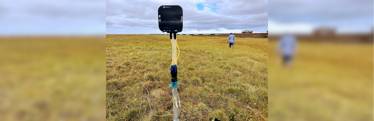
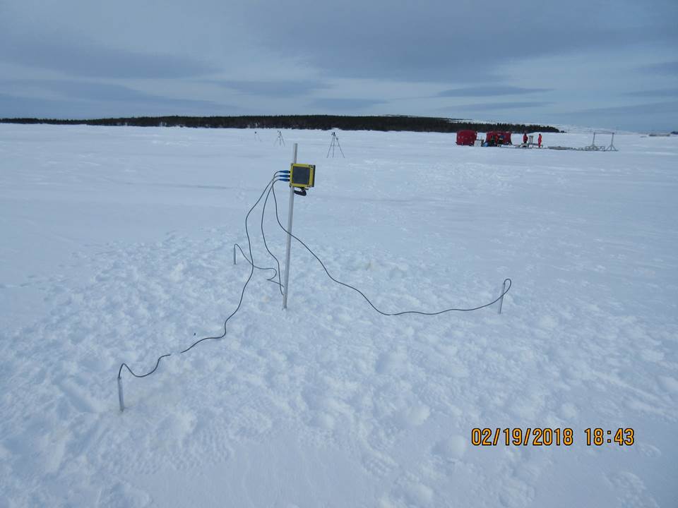
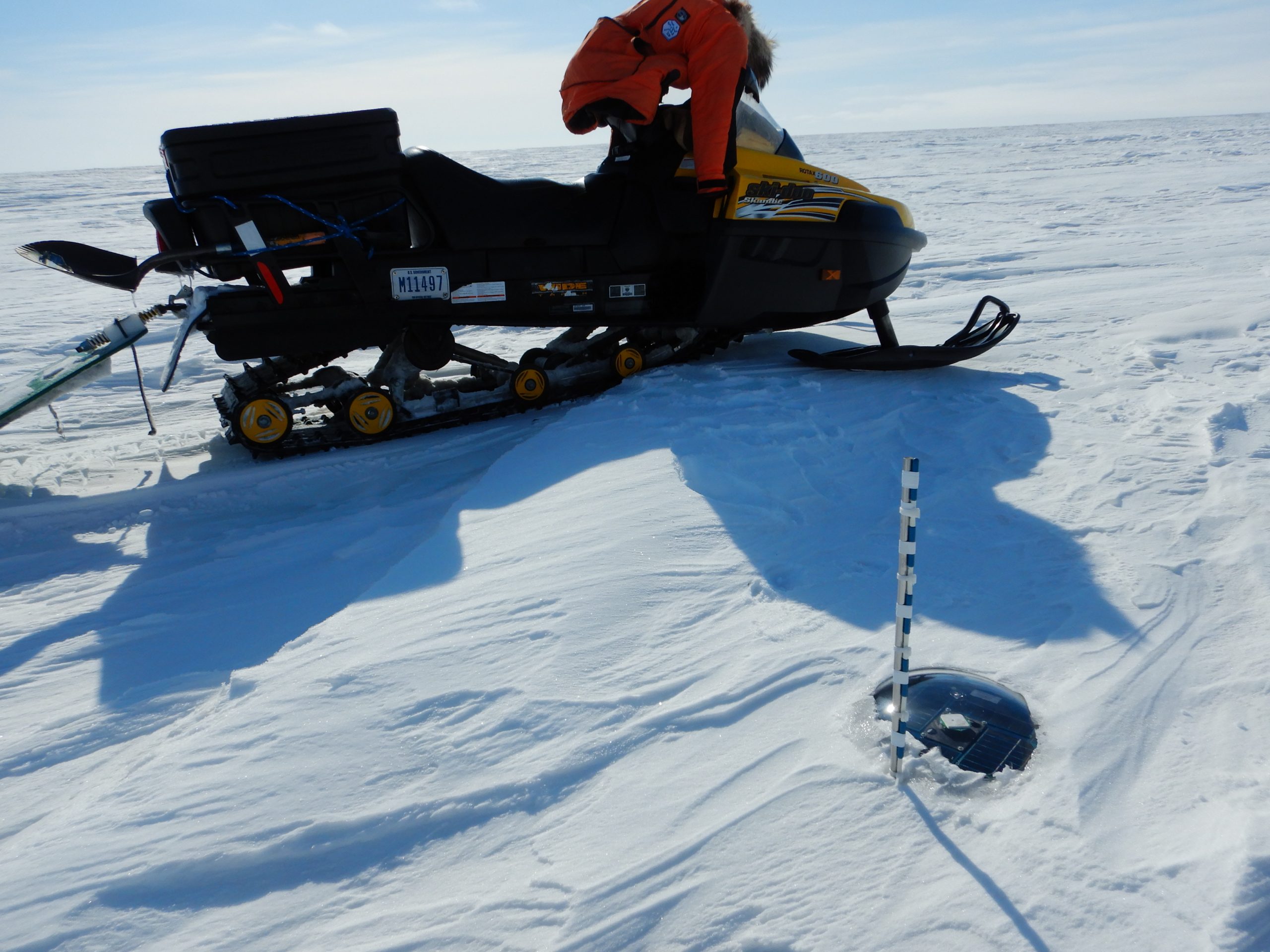
One beadedstream Ice Road station is installed approximately every 5 miles (8 km) along the road. Station locations are chosen to monitor a variety of geographical and soil conditions to verify that all are frozen. The stations are concentrated near the beginning of the road, where construction begins first.
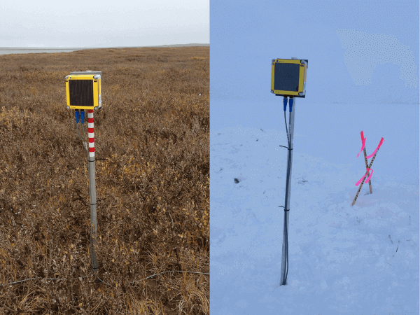
Each station consists of one Data Logger with satellite transmission and two Ice Road Temperature Cables (one for the road centerline and one control cable off the road). Each cable is 1 ft (0.3 m) long with 4 sensors spaced every 4 in. (10 cm).
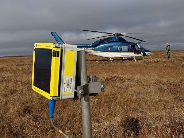
The equipment is installed in late summer prior to the ground freezing and is left in place for about 9 months before it is removed from the site. Access to install and remove the equipment is done via helicopter.
beadedstream Solution Benefits
The operators monitor the tundra temperatures in real-time, via beadedcloud. They can see the current temperatures and forecast the date, to within one day accuracy, that it will reach 23°F (-5°C) at 1 ft (0.3 m) depth. While the air temperature may be well below freezing during the fall, it can take 1-2 months for the active layer to freeze. One week prior to the forecasted day, the operator can start mobilizing their equipment to the area and start discussions with DNR around issuing access permits. They seamlessly provide the DNR user access to their beadedcloud data and share their forecast.
Using this real-time data has allowed operators to get onto the tundra up to 1 to 1.5 months sooner than the general tundra opening dates, providing them with vital extra time to get work done at their drill pads. With the shortening of the season, this has allowed them to still conduct their winter programs.
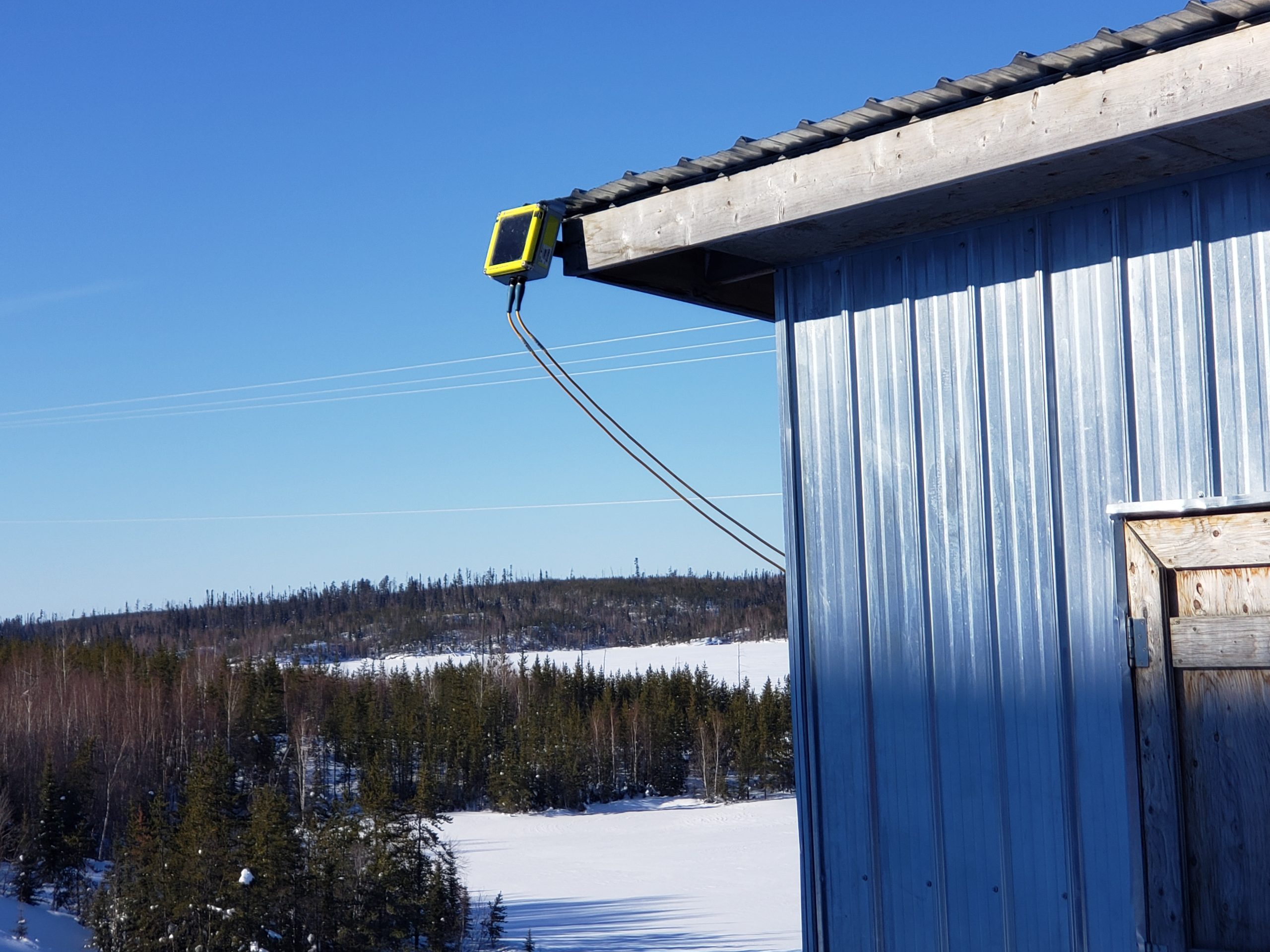
The entire beadedstream system is portable and quick to deploy, allowing the installation team to minimize their helicopter time. The Ice Road Temperature Cables plug straight into the Data Logger (which is mounted onto a post) and no wiring or programming is required. Data begins to transmit via satellite automatically to beadedcloud and can be accessed from anywhere via a web browser, increasing safety and reducing costs by eliminating site visits.
Partner Connectivity Spotlight
Reliable connectivity is critical for ice road monitoring stations installed across remote tundra, where cellular service is often unavailable and field access becomes increasingly difficult once winter conditions set in. For satellite-connected deployments, beadedstream works with Ground Control to support reliable data transmission from remote field sites through the Iridium satellite network.
Ground Control recently featured this application in a case study highlighting how satellite connectivity helps operators monitor tundra conditions remotely, reduce repeated field checks, and plan winter access around real-time ground temperature data.
Read Ground Control’s case study on satellite-connected ice road monitoring.
Featured Product
Ice Road Temperature Cables
Increase the speed and ease of obtaining temperature for your environmental or infrastructure operations with the Digital Temperature Cable from beadedstream.
View ProductExplore Our Most
Recent Case Studies
Learn about our most recent projects and how beadedstream’s products were deployed.