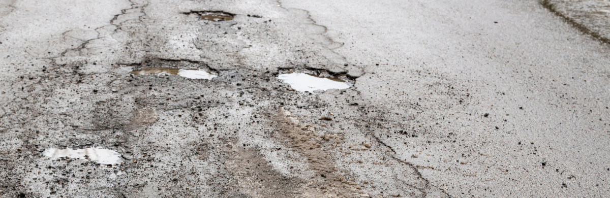
In interior Alaska, farmers are facing an invisible threat growing beneath their fields. As global temperatures rise, the once-reliable permafrost – ground that has remained frozen for decades or centuries – is starting to thaw. When this frozen soil contains significant ice, thawing causes the ground to settle or sink, a phenomenon known as subsidence.
This isn’t just a theoretical concern. Between 2011 and 2017, one study in the Fairbanks region found that agricultural fields experienced up to 1.05 meters of subsidence, reshaping the land’s surface and threatening crop viability . With food security and rural economies at stake, understanding the rate, extent, and cause of permafrost thaw is becoming a critical piece of Alaska’s agricultural resilience.
What We Can See from the Air: The Role of Remote Sensing
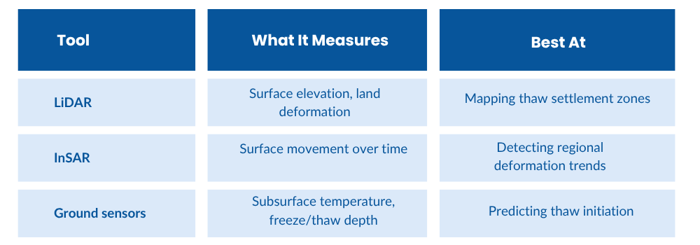
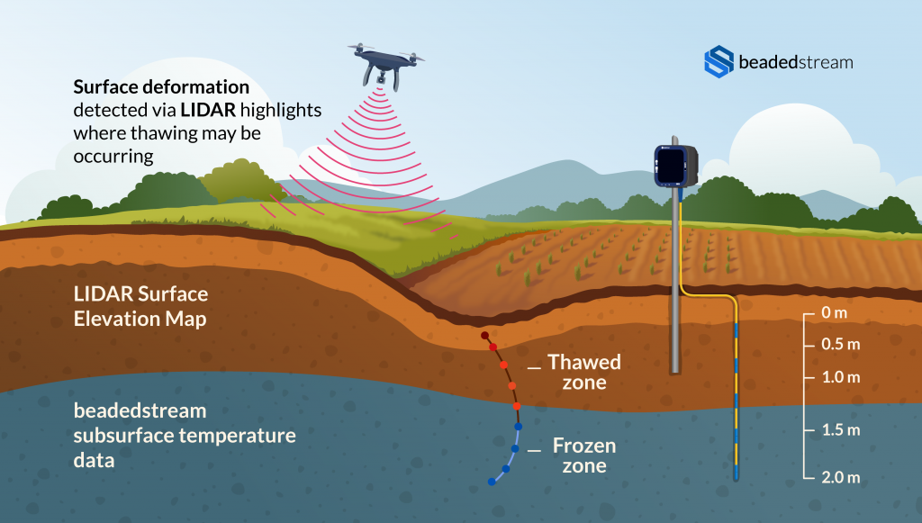
Modern tools like LiDAR (Light Detection and Ranging) and InSAR (Interferometric Synthetic Aperture Radar) are increasingly used to monitor large areas of permafrost terrain. These technologies create precise 3D surface models, detecting elevation changes over time that signal subsidence.
For instance:
- LiDAR data helped researchers detect thaw-related changes across Fairbanks agricultural plots .
- InSAR, paired with ICESat-2 LiDAR data, has mapped permafrost degradation across Alaska’s North Slope over a five-year period, highlighting multi-year active layer thickening trends .
Remote sensing is a powerful tool for identifying “where” the land is shifting.
The Missing Dimension: Subsurface Temperature Data
Understanding thaw dynamics requires more than surface imagery. Temperature profiling below ground reveals the internal conditions that cause thaw – such as soil moisture, freeze/thaw cycles, and the depth of the active layer (the zone that freezes and thaws seasonally).
Here’s why it matters:
- In the Permafrost Grown project, scientists found that certain mulching strategies used in farming caused warming in the soil, increasing temperatures up to 1 meter below the surface .
- These temperature shifts, often invisible at the surface, can lead to accelerated degradation of ice-rich permafrost, especially when coupled with land clearing, tilling, or irrigation.
Without monitoring subsurface conditions, interventions based solely on surface change may come too late.
A Holistic Monitoring Strategy for Agricultural Resilience
To create sustainable land-use strategies in permafrost regions, a multi-modal monitoring approach is needed. Here’s how the pieces fit together:
These methods, when combined, give stakeholders a wider view of both the causes and effects of permafrost degradation – a capability that is especially valuable in agricultural fields where early warning is critical for seasonal planning.
The beadedstream Approach: Seeing Below the Surface
At beadedstream, we work with researchers, engineers, and government agencies to provide reliable ground-based temperature monitoring in Arctic and sub-Arctic environments. Our Digital Temperature Cables (DTCs) offer precise thermal profiling at multiple depths – with ruggedized designs suited for agricultural sites.
These solutions are already used in Alaska and Northern Canada for permafrost characterization, and they can:
- Detect subsurface warming trends before visible change occurs
- Track the depth of freeze/thaw cycles over time
- Support long-term studies on land-use impact from farming practices
By complementing LiDAR and satellite datasets, temperature monitoring helps fill critical data gaps – bringing time-sensitive, below-ground insights to the surface.
Looking Forward: Data-Driven Land Management in a Changing Climate
Permafrost thaw isn’t uniform – it’s site-specific, influenced by vegetation, soil composition, land use, and microclimates. That’s why a ground-truthed, data-rich approach is key.
For agricultural stakeholders and researchers working in northern regions, this means:
- Building hybrid monitoring systems using both remote sensing and in-situ data
- Designing adaptive farming practices based on long-term thaw projections
- Protecting valuable land before it becomes unusable
As Alaska – and the broader circumpolar north – continues to warm, the tools we use to monitor permafrost must evolve. With both aerial and underground insights, we can take a proactive stance on climate resilience, crop protection, and sustainable food systems in the North.